Map Window Tools
Map Window
Overview
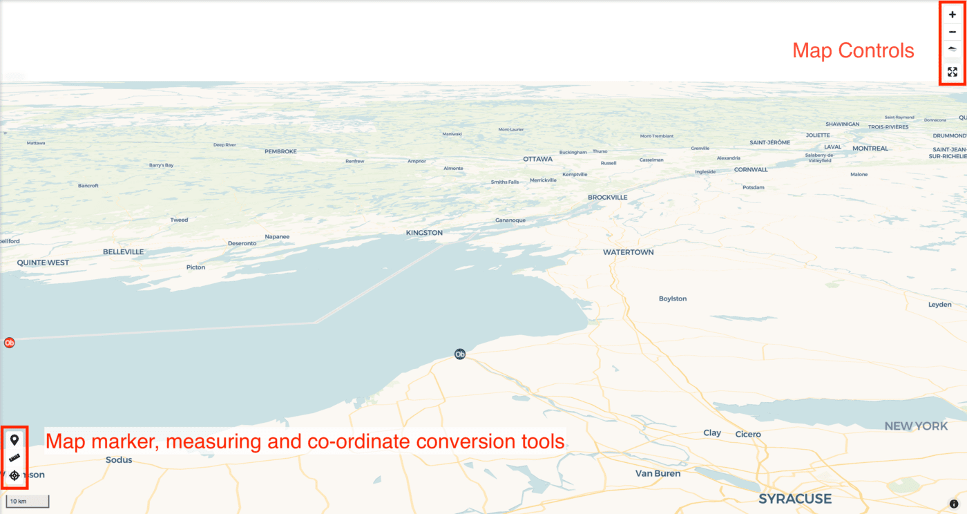
The map window can be navigated with left click + drag or using keyboard arrows. To zoom in or out use the scroll wheel, the + and - map controls or shift + click and drag to zoom to a certain area. Map orientation can be adjusted using right click + drag and reset using the north arrow map control button. The map can also be made full screen using the full screen map control button.
Clicking on project and some reference map features brings up a popup with feature attribute information. From here you can also switch off the layer using the toggle.
Show Coordinates Tool
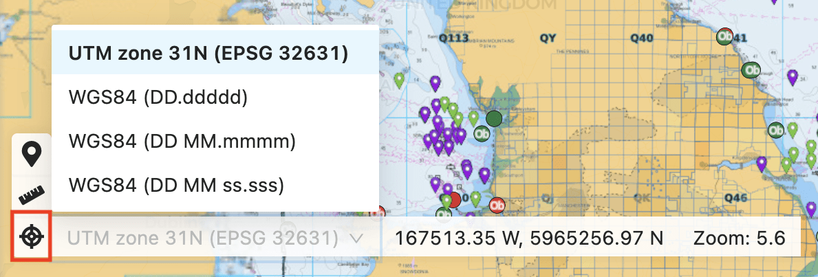
Click to expand this tool and show the coordinates of the mouse pointer position. This will have options to switch between assigned project coordinate reference systems and the World Geodetic System 1984 (WGS84) in various formats e.g. Decimal degrees or degrees,minutes & seconds. This may be useful for translating individual coordinates.
You can also right click on the map to show co-ordinates of the current location.
Measure Tool
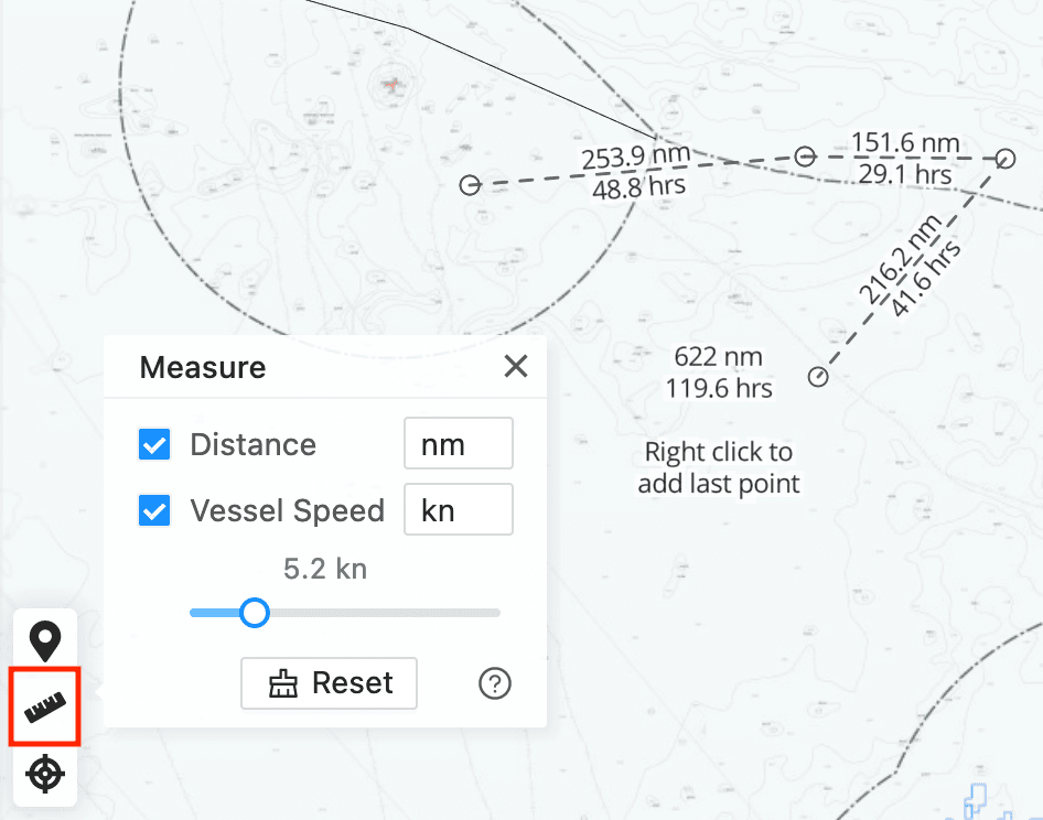
Click the ruler icon to expand the Measure tool. This allows to measure distance and time based between points. First tick the options, then select the units and if measuring time enter a vessel speed value. Once configured click points on the map and use right click to finish or minimize the Measure tool. Use the Reset button to start a new route.
Drawing Tools
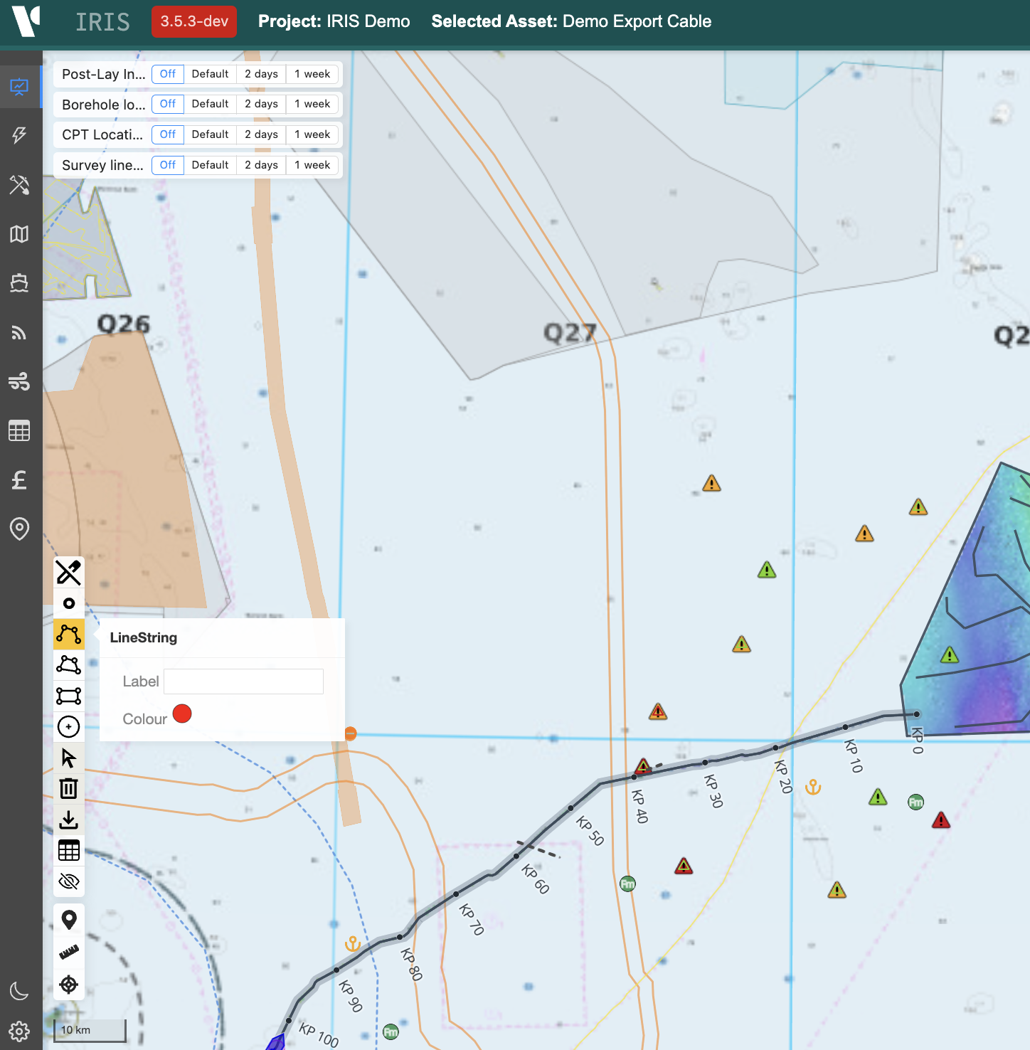
In the bottom left of the map, drawing tools can be opened and closed by clicking the pencil icon. Hover over each icon to see what shape they create. You can add a label before drawing by typing in the box. You can view the data in a table by clicking the table icon and download it by clicking download to get a geojson which can be used in GIS software.
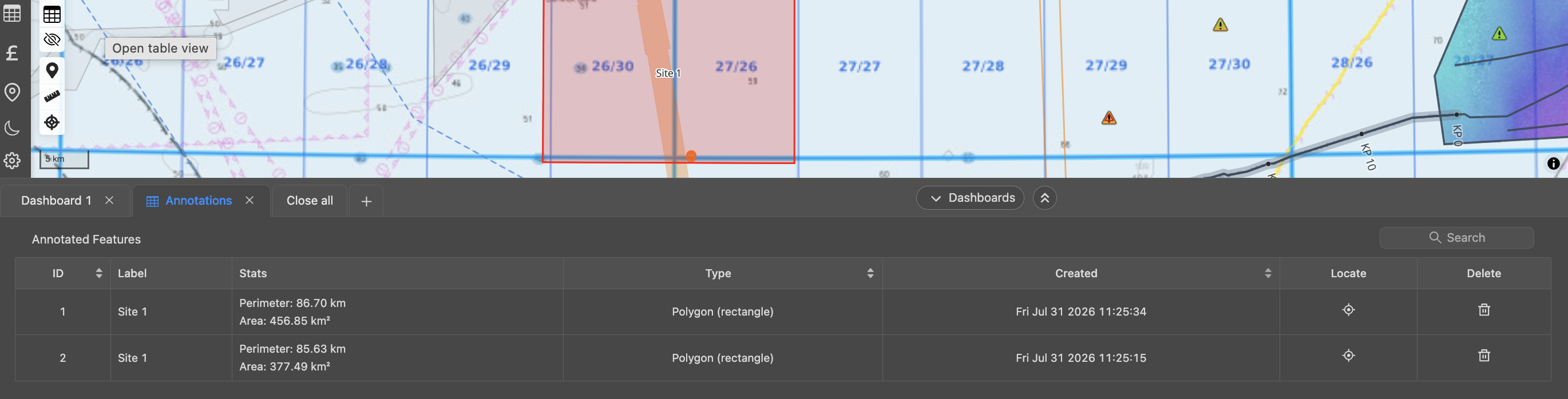
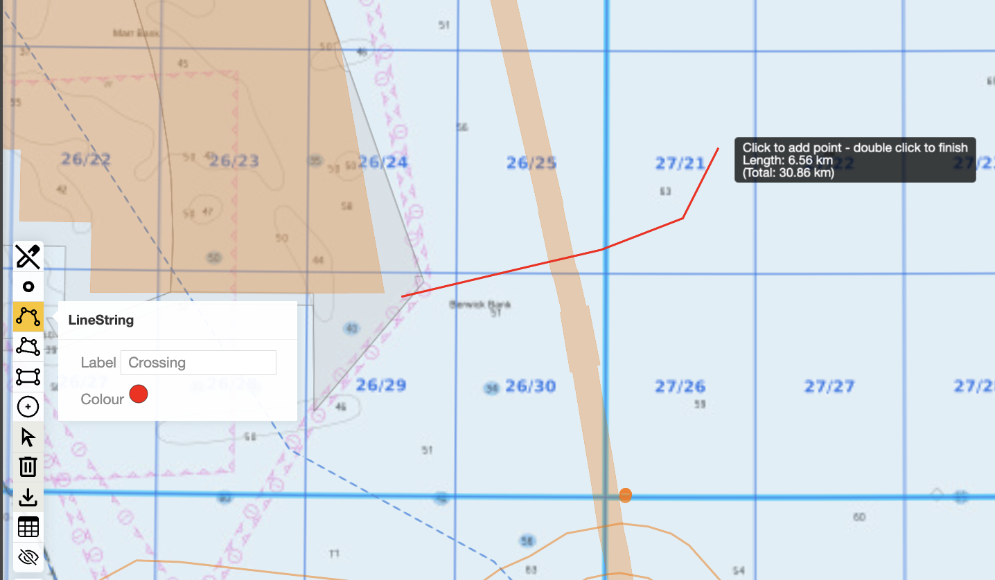
Before adding shapes you can set the label and the colour in the popup next to the shape icons. When creating a shape follow the instructions for each. For instance, with a line you click to add nodes and double click to finish the shape. The tool automatically shows distance and/or area as you draw.
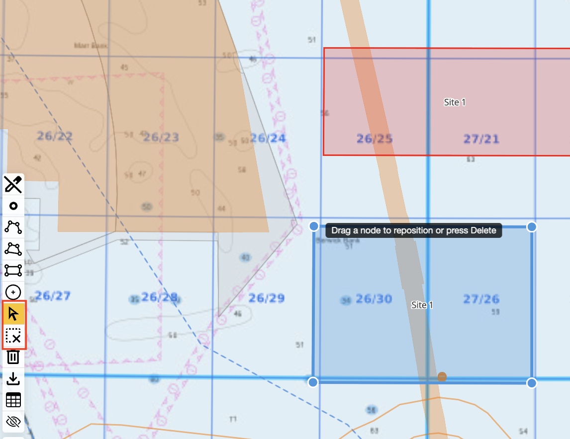
To edit shapes e.g. adjusting nodes,moving objects or deleting individual shapes, click the mouse pointer icon and delete with the x icon below.
Adding Map Markers
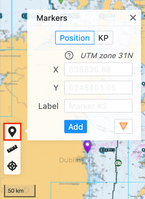
Temporary map markers can be created using map pin icon. These could be placed manually on the map, specified by Kilometer Point (KP) along the current selected cable or pipeline Asset or by typing the coordinate values. You can switch between coordinate systems at any point by using the Show Coordinates tool. This may be useful for translating individual coordinates.
Please note that these only persist in a single IRIS session and will not be viewable by other users. To add a permanent layer contact the IRIS team.