
Submarine & Interconnector Cable Installations
Submarine & Interconnector Cable Installations
Submarine and interconnector cable projects span years and involve multiple contractors, survey campaigns, and installation phases across long, complex routes. IRIS brings the entire lifecycle into a single contractor-agnostic platform - from pre-construction geophysical surveys through cable lay, burial, and post-installation inspection - giving project teams and client representatives a continuous, structured picture of operations regardless of who is offshore.
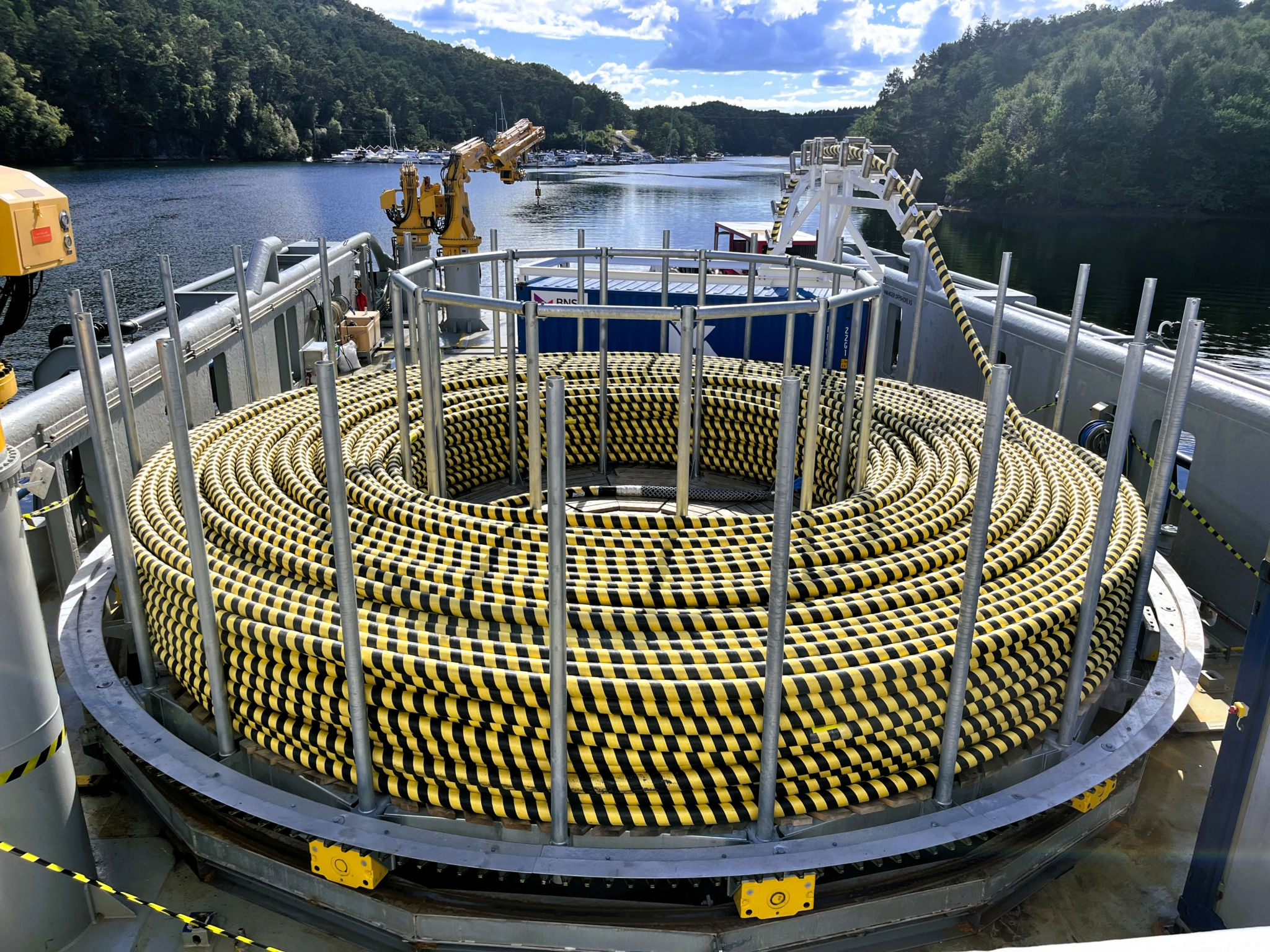
The challenge
Cable projects generate large volumes of data across multiple activities and contractors. Route corridor surveys, geotechnical investigations, cable lay, burial, and inspection campaigns all produce datasets that are typically managed separately, handed over in different formats, and held by different parties.
For the client, this creates a fragmented view of the project. Progress against programme is difficult to track in real time, data acquired at cost during pre-construction surveys can be hard to retrieve during installation, and lessons from one campaign are rarely available to the next team offshore.
How IRIS helps
IRIS consolidates survey data, vessel positions, installation progress, and operational reporting into a single browser-based platform, accessible to the entire project team from anywhere.
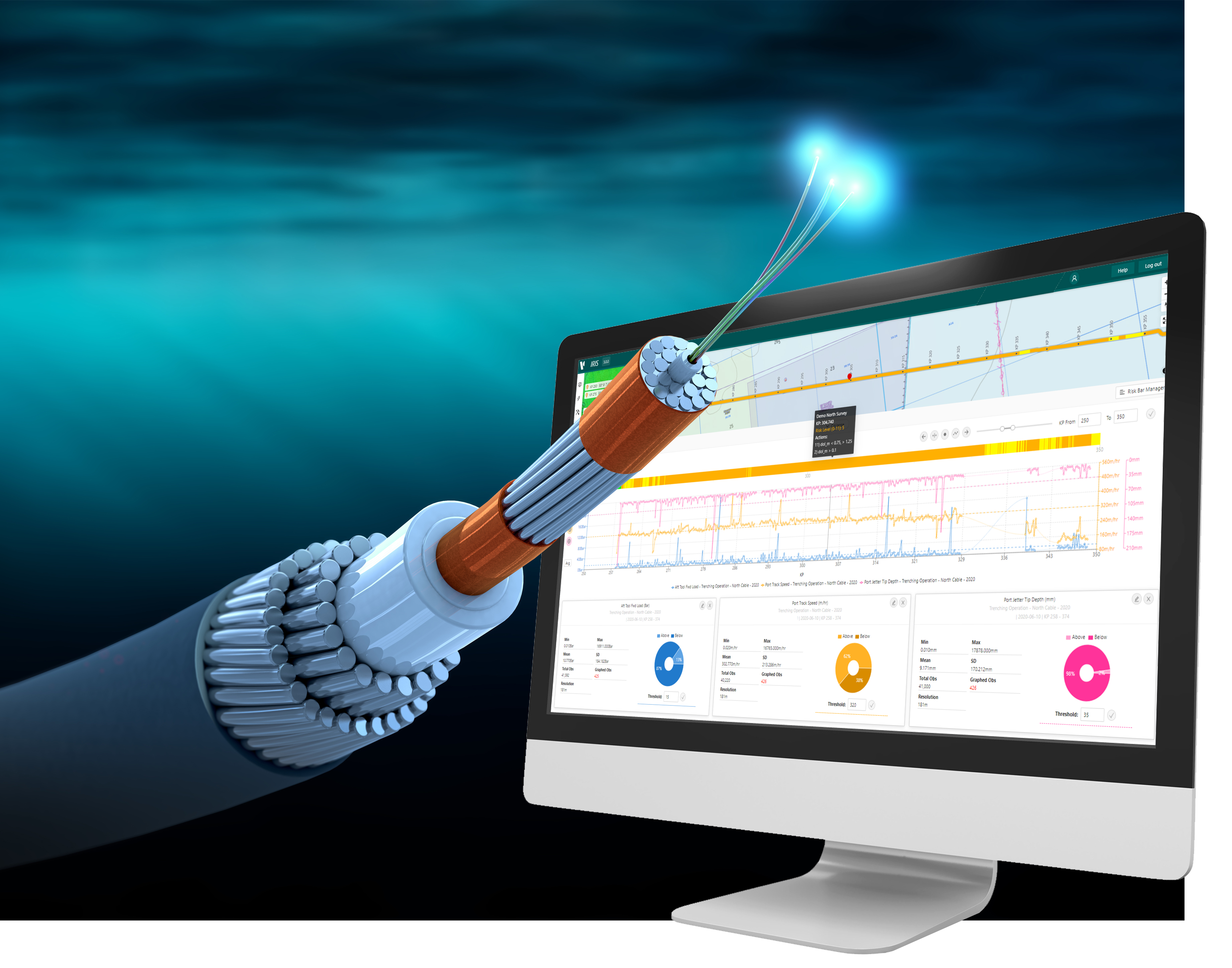
Pre-construction surveys
Before installation begins, IRIS serves as the repository for all route corridor survey data:
- Geophysical data layers including bathymetry, sidescan sonar, sub-bottom profiles, and seabed classification displayed directly on the interactive web map
- Geotechnical site investigation results linked by route KP, including CPT profiles, core logs, and laboratory data
- Identified seabed features, hazards, and infrastructure crossings spatially referenced along the route corridor
- Comparison of repeat survey datasets to identify seabed change between campaigns
Cable lay monitoring
During the installation campaign, IRIS tracks progress in real time:
- Vessel tracking - cable lay vessel, burial equipment, and support vessels displayed live on the web map with AIS and tracker integration
- KP progress - as-laid cable position tracked along the planned route, with outstanding sections clearly visible
- Cross-track deviation - as-laid position monitored against the approved cable route corridor
- Lay speed and tension - operational parameters streamed from onboard cable lay systems and tested against entered thresholds
- Touchdown monitoring - cable departure angle and estimated touchdown point tracked during deepwater lay operations
Burial and depth of burial QC
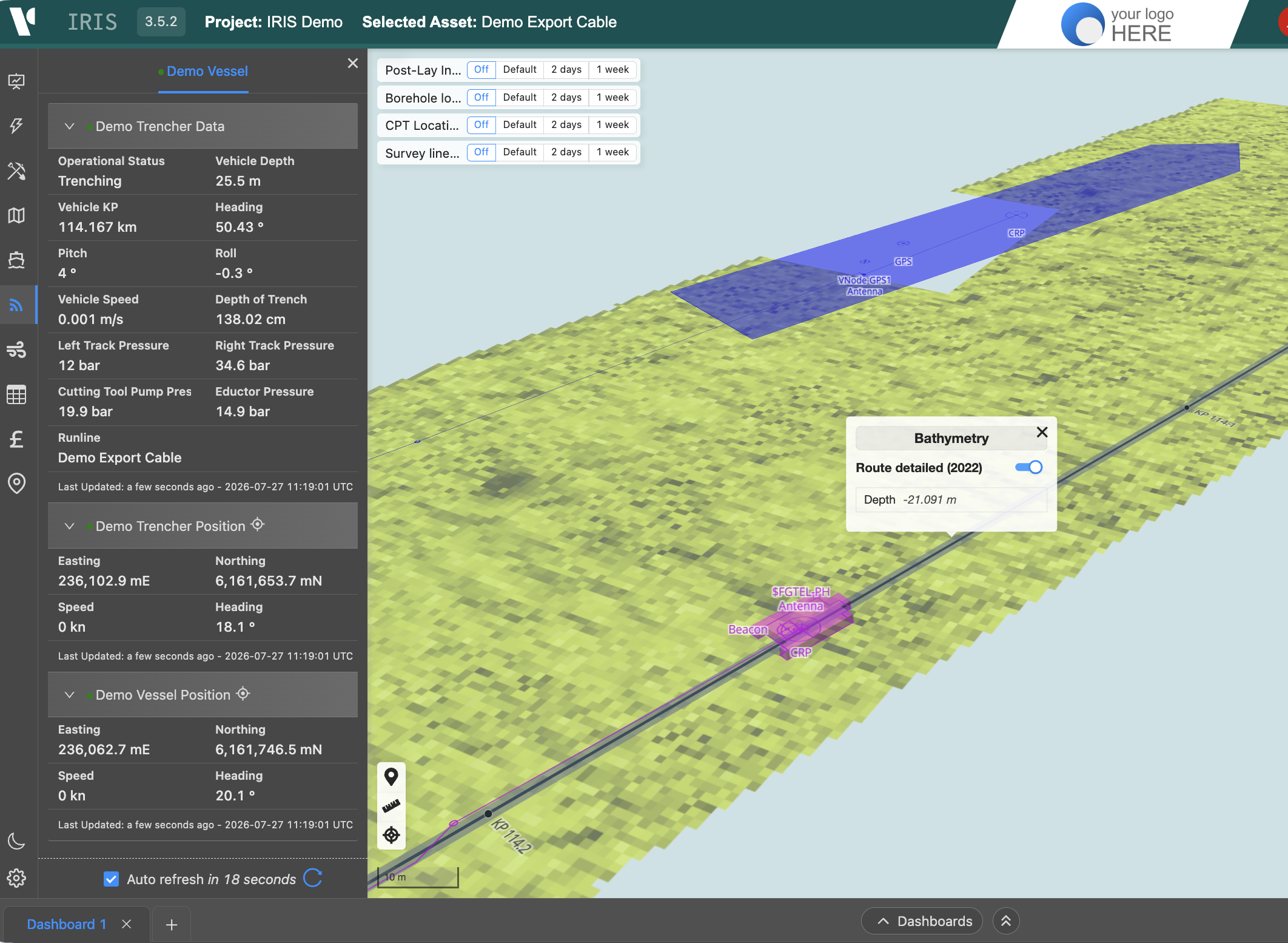
IRIS supports real-time cable burial assessment through the CableQC dashboard:
- Raw data streamed from onboard burial systems including jet trenchers, plough, and ROV burial tools
- Depth of burial (DoB) measured and displayed by KP along the as-laid route
- Burial results tested against the project burial depth specification, with threshold exceedances flagged immediately
- Risk bars generated for as-installed cable sections, classifying burial adequacy along the full route length and informing O&M risk assessment and future inspection prioritisation
- Post-lay inspection data ingested and compared against as-installed burial results to identify sections requiring remedial burial
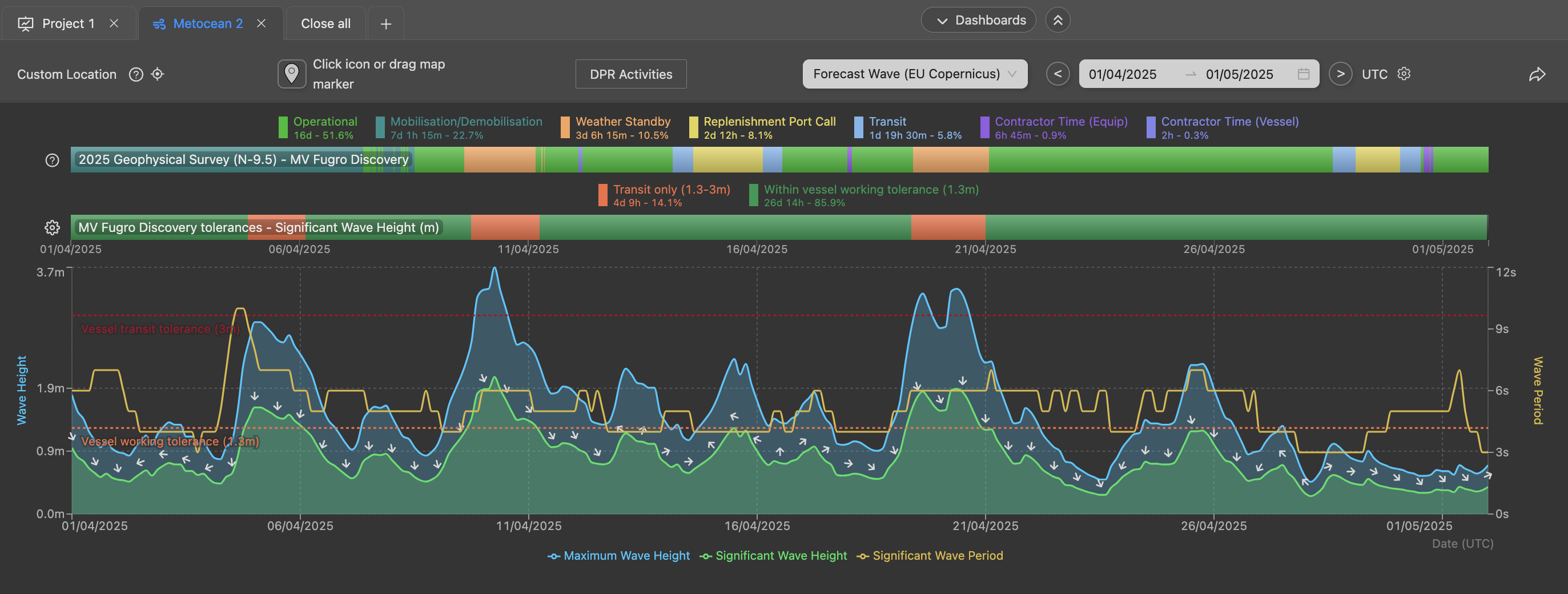
Project management and reporting
Throughout the campaign, IRIS maintains the operational record:
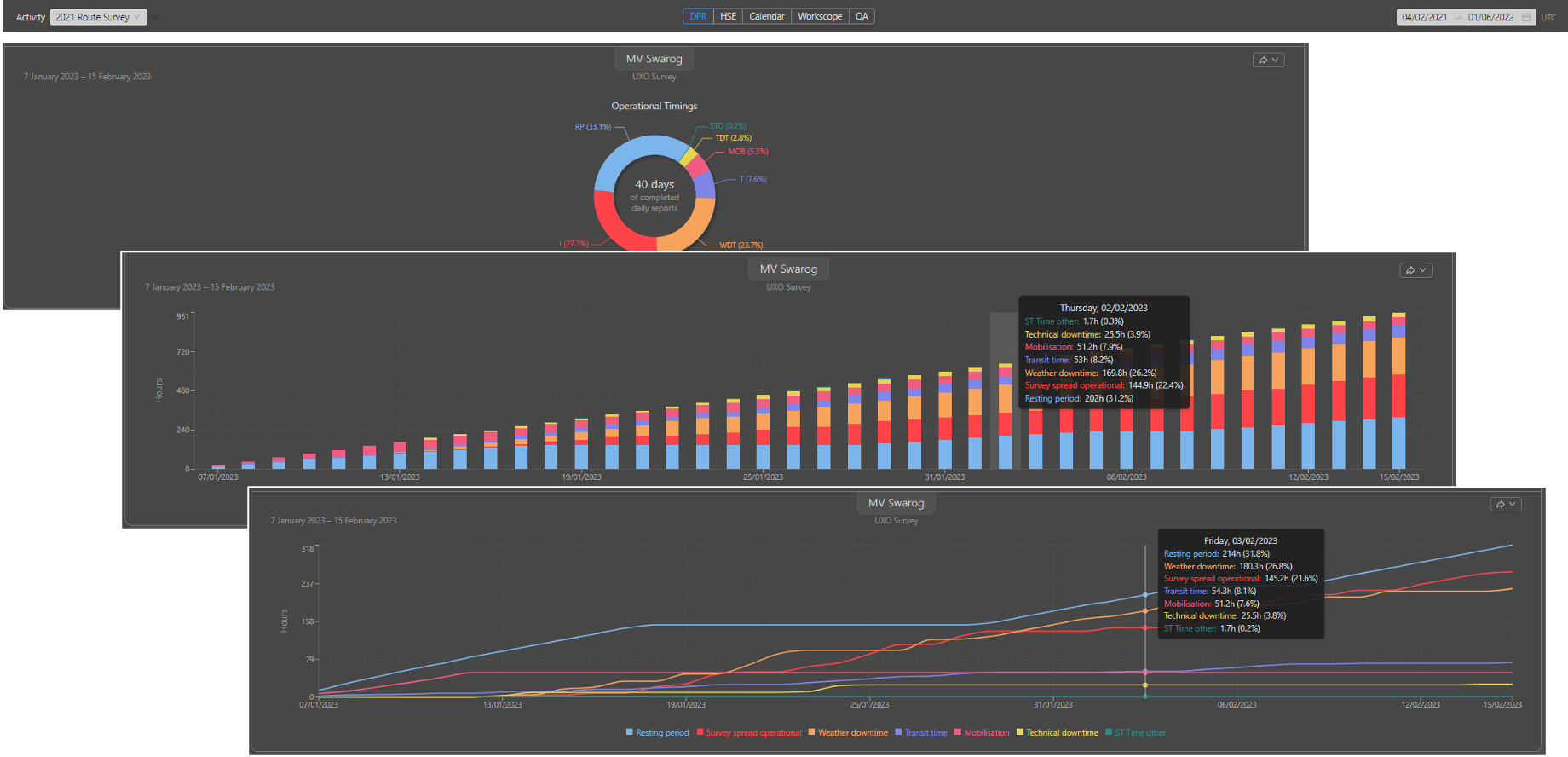
- Daily Progress Reports (DPRs) and HSE observations uploaded by the offshore client representative and accessible onshore in real time
- Project progress tracked against programme with live visibility of advance rates, downtime, and forecast to completion
- Metocean conditions at the installation location accessible for weather window assessment and operability review
- QA/QC reports generated directly from IRIS data at demobilisation
What IRIS monitors
| Parameter | Description |
|---|---|
| As-laid KP position | Cable position along route tracked continuously during lay |
| Cross-track distance | Deviation of as-laid position from approved route corridor |
| Depth of burial | Measured burial depth by KP from burial system data streams |
| Risk bar classification | Burial adequacy assessment against specification thresholds |
| Vessel positions | Cable lay vessel, burial tool, and support fleet tracked live |
| Lay tension and speed | Operational parameters streamed and threshold-tested |
| Metocean conditions | Wave, wind, and current at the installation location |
| DPR and HSE records | Operational reporting uploaded and accessible in real time |
Data management across the asset lifecycle
One of the most significant benefits IRIS provides on cable projects is the continuity of data access across the full asset lifecycle.
Pre-construction survey data acquired before installation is held in IRIS and remains accessible to the installation team, burial contractor, and inspection teams in subsequent years - independently of the original survey contractor's systems. Depth of burial data from installation is available for direct comparison against post-lay inspection results. Lessons learned from one campaign are recorded and searchable for future operations on the same asset.
This means data is never lost when contractors demobilise, personnel change, or contracts move between parties.
Key capabilities
Contractor-agnostic
IRIS sits independently of any contractor's own data management systems. The client retains access to all project data regardless of which contractors are engaged at any point in the project lifecycle.
Live client access
Client representatives and project managers onshore can monitor installation progress, vessel positions, burial depth, and operational reporting in real time without relying on contractor updates.
CableQC risk bars
Burial adequacy is assessed against project specification thresholds and presented as risk bars along the full cable route - providing an immediate, visual record of as-installed burial performance for O&M planning.
Applicable cable types
- Export cables - offshore wind farm array and export cable installations
- HVDC interconnectors - high-voltage direct current submarine interconnectors between countries or grid systems
- Fibre optic cables - subsea telecommunications and data cables
- Umbilicals and flexible flowlines - where burial monitoring and KP tracking are required
Related IRIS capabilities
- Vessel Tracking - real-time and historical vessel positions on the IRIS web map
- CableQC - streaming burial data and depth of burial QC
- Project Management - live project progress, DPR access, and QA/QC reporting
- Metocean - hindcast and forecast environmental conditions at the cable location
- Data Management - structured data access across the full project and asset lifecycle