
Project Activities Module
Activities Module
Any offshore energy Project consists of many data-harvesting Activities through its life cycle from design and development, through construction, operation and finally into decommissioning.
The IRIS Activities module is designed to be a sequential record of all of these individual activities, providing efficient access to project information, data and performance and quality information. In this way, data will never be 'lost' and future planned surveys can be checked and optimised against existing data. In the event of future offshore interventions, for example a submarine cable repair, the sequencing and performance of related installation activities is quickly established. Similarly Lessons Learnt and recommendations are forever available for subsequent assessment.
For a single Project, such as an OWF development, interconnector cable installation or oil and gas field development, the Activities module holds data and information from multiple Activities representing geophysical surveys, geotechnical site investigations, offshore construction, subsea rock installations and subsea inspection.
IRIS is structured such that all Activities are captured in a time sequential manner, making all project information and data efficient to find and access.
At the highest level, Activities are categorised by the Project Phase in which they fall, of which there are 3 defined:
- Pre-Construction (includes rig moves)
- Construction
- Operations & Maintenance (IRM)
Within each Phase, a number of operational groups (Operations) are defined and within each Operation, various Activities are undertaken.
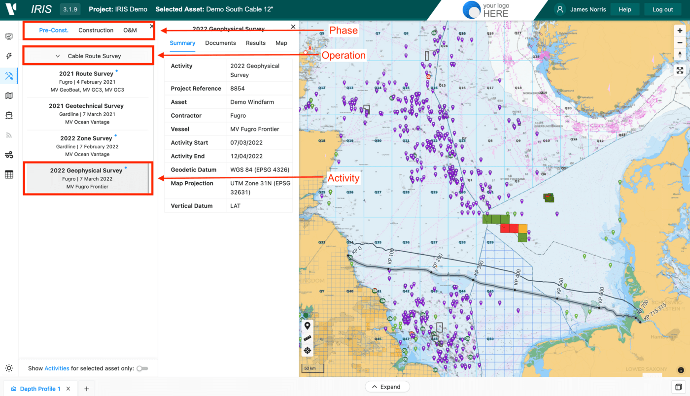
When an Activity is first selected, a Details pane is presented providing access to 4 panels:
Summarypanel - details high level information about theActivityincluding Type, Name, Geodesy, Contractor, Vessels and key datesDocumentspanel - containsActivityoperational documentation including Daily Progress Reports (DPRs), mobilization, HSE and OCR reportsResultspanel - provides access to survey reports, charts, core logs, photos, vide, listings etc.Mappanel - provides access to mapping data layers e.g. workscope elements, bathymetry, seabed features etc.