
Oil & Gas Developments
Oil & Gas Developments
Oil and gas field development involves a complex sequence of survey, drilling, and installation activities spanning multiple years and contractors. IRIS provides operators with a contractor-agnostic platform to monitor operations, manage data, and retain knowledge across the full field development lifecycle - from pre-drill site surveys through drilling campaigns, pipeline and umbilical installation, and ongoing asset inspection.
The challenge
Oil and gas projects bring together large, multi-disciplinary teams across long timeframes. Survey contractors acquire geophysical and geotechnical data during site characterisation. Drilling contractors mobilise MODUs for well campaigns. Installation contractors lay pipelines, umbilicals, and flowlines. Inspection contractors return year after year to assess asset integrity.
Each of these activities generates data and operational records that are typically held by the contractor responsible, making it difficult for the operator to maintain a coherent, accessible view of what has been done, what was found, and what was decided - particularly as personnel and contractors change over time.
How IRIS helps
IRIS sits on the operator side of the project, independent of any contractor, and provides a single platform for monitoring operations and managing the data and knowledge generated across every phase.
Pre-drill site surveys
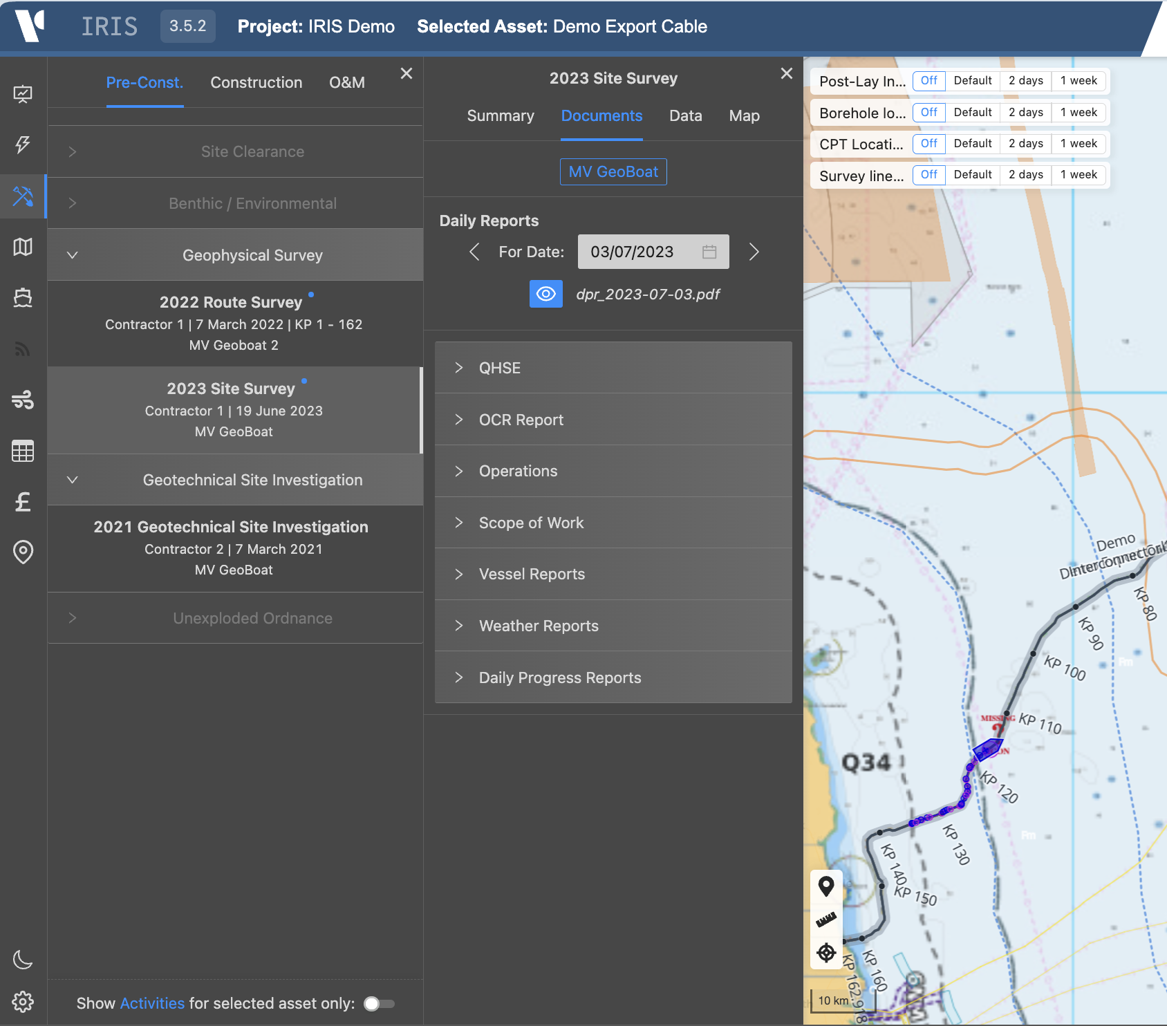
IRIS manages the geophysical and geotechnical data acquired to characterise a field or well location before drilling begins:
- Geophysical survey data including bathymetry, sidescan sonar, sub-bottom profiles, and shallow seismic displayed on the interactive web map
- Geotechnical site investigation results linked by location - CPT profiles, borehole logs, core photography, and laboratory data accessible from the map
- Identified seabed hazards, shallow gas indicators, and existing infrastructure referenced spatially for well planning and SIMOPS purposes
- Survey vessel tracking and progress monitoring during the acquisition campaign
Drilling operations
During well campaigns IRIS provides real-time operational visibility alongside the Positioning QC capability:
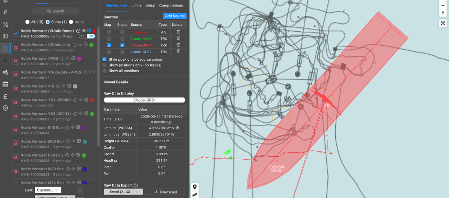
- MODU tracking - drillship or semi-submersible position displayed live on the web map alongside nearby vessels and subsea infrastructure
- Remote Positioning QC - independent verification of the drilling unit's position at the well location using V-Node hardware, delivered entirely onshore without personnel on the rig (see Drillship & Rig Positioning QC)
- SIMOPS monitoring - vessel positions across the field displayed simultaneously, supporting safe simultaneous operations planning and execution
- Daily reporting - DPRs, HSE observations, and operational records uploaded and accessible onshore in real time
- Metocean context - hindcast and forecast weather and sea state at the well location for operability assessment
Pipeline, umbilical, and riser installation
IRIS supports installation campaigns with the same vessel tracking and data management capabilities applied to subsea infrastructure:
- Installation vessel and support fleet tracked live during pipelay, J-lay, and reel-lay operations
- As-laid route tracked by KP against the approved pipeline corridor
- Free-span survey data and seabed intervention records managed alongside the as-built dataset
- Rock dump and mattress placement data linked spatially to the pipeline route
Asset inspection and integrity
As the field matures, IRIS retains the full history of survey and inspection data for integrity management:
- Repeat inspection datasets held in sequence, allowing direct comparison between campaigns to identify change
- Corrosion, free-span, and anomaly records linked by KP and accessible from the web map
- Contractor inspection reports, photographic records, and ROV video references retained alongside the spatial data
- Data available to inspection planners independently of the original survey contractor
What IRIS monitors
| Parameter | Description |
|---|---|
| Vessel positions | MODU, installation vessels, support fleet, and supply vessels tracked live |
| MODU positioning | Independent V-Node position QC and drill-centre verification |
| Survey progress | Line coverage, data acquisition status, and outstanding areas |
| KP progress | As-laid pipeline or umbilical position tracked along the approved route |
| Metocean conditions | Wave, wind, and current at the field location |
| DPR and HSE records | Daily reporting accessible onshore in real time |
| Geophysical data | Survey layers displayed on the web map by activity and data type |
| Geotechnical data | CPT, borehole, and laboratory results linked by location |
Knowledge retention across the asset lifecycle
Oil and gas assets operate for decades. The value of data acquired during early-phase surveys and drilling campaigns compounds over time - but only if that data remains accessible. IRIS ensures that data acquired at significant cost is never lost when contractors demobilise, personnel leave, or project records are archived.
Survey data from the initial site characterisation is available to the installation team years later. Drilling records are accessible to the integrity management team during the production phase. Inspection findings from previous campaigns are available to planners before the next survey mobilises.
This continuity of data access is particularly valuable on fields where multiple operators have held equity over time, or where long gaps between campaigns mean that institutional knowledge has been lost.
Key capabilities
Contractor-agnostic oversight
IRIS monitors performance and manages data independently of any individual contractor. The operator retains a consistent view of project performance and data access regardless of which contractors are engaged at any point.
Remote Positioning QC
Well location verification is delivered entirely from onshore using V-Node telemetry and the IRIS web map - reducing cost and HSE exposure without compromising the standard of independent QC.
SIMOPS situational awareness
All vessel positions across a field are displayed simultaneously on the IRIS web map, giving operations coordinators and marine assurance teams a live picture of relative positions and activities.
Related IRIS capabilities
- Drillship & Rig Positioning QC - remote well location verification using V-Node hardware
- Vessel Tracking - real-time and historical vessel positions on the IRIS web map
- Project Management - live project progress, DPR access, and QA/QC reporting
- Metocean - hindcast and forecast environmental conditions at the field location
- Data Management - structured data access across the full project and asset lifecycle