Plotting Points of Interest
Points of Interest Module
The Points of Interest (POI) module allows specific users to enter location or line co-ordinates into a table which populates certain visible layers on the map. The IRIS Support team can configure layers as required. For example a Fishing Gear Point and Line table might be required for FLOs to fill in on a daily basis or a list of priority investigations zones could be marked on the map.
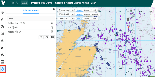
These layers will appear as read-only in the Data Entry Module and on the map and visible to all users.
To add new data click to expand the relevant layer. This will expand a table like below:
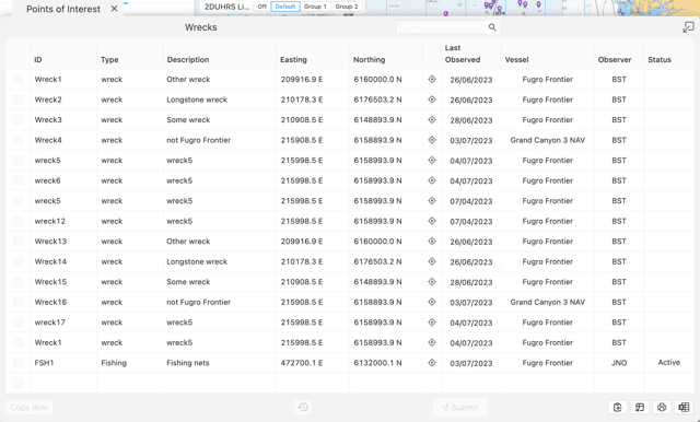
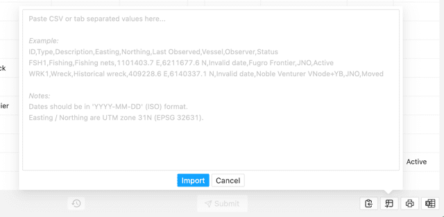
You can either enter locations manually by filling in all the columns for a single row or by importing from a spreadsheet using the buttons in the bottom right of the window:

When importing make sure the column headers and data match what is provided in the example. For points an X and Y co-ordinate is required. For lines a start and end X and Y is required.
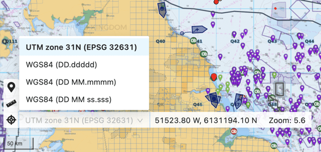
If you want to work with latitude and longitude instead of the project co-ordinate system, you can change between systems using Tools in the bottom left of the map window: