
Offshore Wind Developments
Offshore Wind Developments
Offshore wind farm development spans a decade or more from early-stage site characterisation through construction and into long-term operations. IRIS supports developers, OFTOs, and their project teams across every phase - providing a contractor-agnostic platform to monitor survey and construction activities, manage the growing archive of site data, and retain the operational knowledge that informs future campaigns.
 Photo by Nicholas Doherty on Unsplash
The challenge
Offshore wind projects involve large numbers of contractors working across extended timelines. Geophysical and geotechnical survey contractors characterise the site during development. Installation contractors mobilise for foundation, turbine, and cable campaigns. Inspection and maintenance contractors return throughout the operational life of the asset.
At each stage, data is generated and held by the contractor responsible. Without a client-side platform to consolidate this data, developers risk losing access to information when contracts change, facing costly re-acquisition of data that already exists, and making installation and maintenance decisions without the benefit of the full site history.
How IRIS helps
IRIS provides the developer with a single, persistent view of the site and the project - accessible from any browser, independent of any contractor, and maintained across the full asset lifecycle.
Site characterisation surveys
The earliest phase of a wind farm development involves geophysical and geotechnical surveys to characterise the seabed and subsurface conditions across the site. IRIS manages this data from the outset: 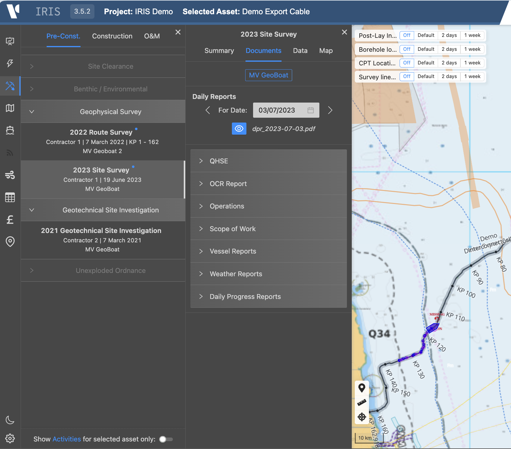
- Geophysical survey data including multibeam bathymetry, sidescan sonar, sub-bottom profiles, and shallow seismic displayed on the interactive web map
- Geotechnical site investigation results - CPT profiles, borehole logs, core photography, and laboratory data - linked by location and accessible from the map
- Seabed feature mapping and hazard identification, including mobile bedforms, boulders, existing infrastructure, and shallow gas indicators
- UXO survey results and clearance records spatially referenced across the development area
- Repeat survey comparison to identify seabed mobility and change between campaigns
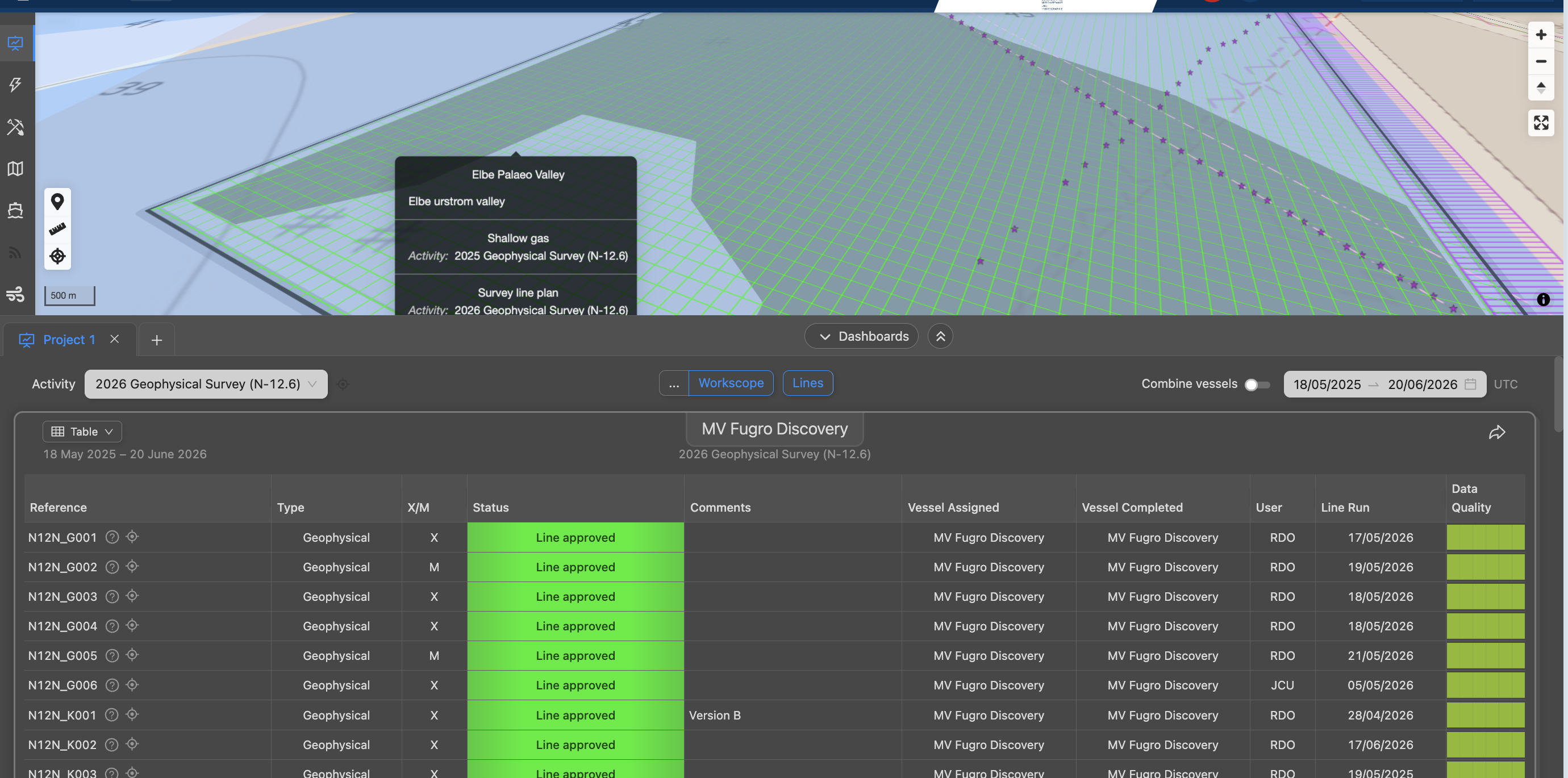
Survey vessel positions and line coverage are tracked during acquisition, giving the developer live visibility of progress against the survey programme.
Foundation and turbine installation
During the construction phase IRIS provides real-time monitoring of the installation campaign:
- Vessel tracking - installation vessels, crane barges, accommodation vessels, and the support fleet all tracked simultaneously on the web map
- WTG and foundation progress - installation status tracked by turbine position across the array, with completed, in-progress, and outstanding locations visible at a glance
- SIMOPS management - multiple vessels and activities across the field displayed simultaneously to support safe simultaneous operations planning
- Daily reporting - DPRs, lift records, HSE observations, and commissioning records uploaded and accessible onshore in real time
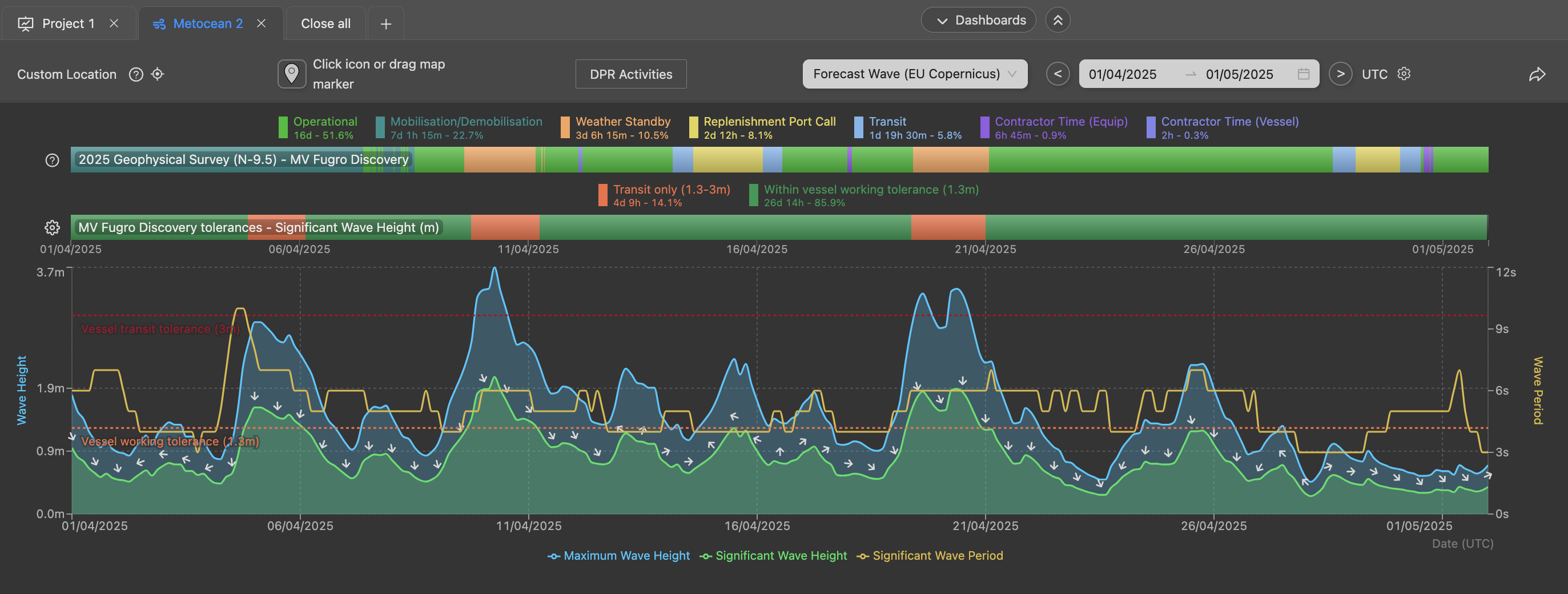
- Metocean monitoring - wave, wind, and current conditions at the site for weather window assessment and operability review during heavy lift and installation operations
Export and inter-array cable installation
Cable installation campaigns are supported through the CableQC module alongside the core vessel tracking and project management capabilities:
- Cable lay vessels and burial equipment tracked live during export cable and inter-array cable installation
- As-laid cable position tracked by KP against the approved cable route corridor
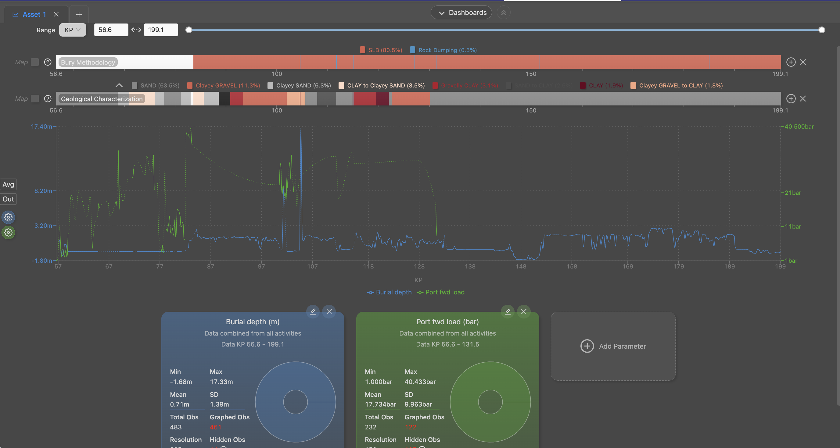
- Depth of burial monitored in real time from onboard burial system data streams, with results tested against the burial depth specification
- Risk bars generated for as-installed cable sections, providing an immediate assessment of burial adequacy for O&M planning
- Post-lay inspection data ingested and compared against as-installed results to identify sections requiring remedial burial
Operations and maintenance
IRIS retains the full site history through the operational life of the asset, supporting the O&M team and future survey planning:
- All pre-construction and construction phase data remains accessible - survey results, installation records, and operational reports are available to the O&M team without reference to the original contractors
- Repeat inspection datasets held in sequence, allowing direct seabed change detection and structural assessment comparison between campaigns
- Scour monitoring data tracked by foundation location and campaign to identify developing scour features requiring intervention
- Cable inspection results - depth of burial, free-span, and anomaly records - available alongside the as-built dataset for integrity management
What IRIS monitors
| Parameter | Description |
|---|---|
| Vessel positions | Installation fleet, cable lay vessels, jack-ups, and support vessels tracked live |
| WTG installation status | Foundation and turbine installation progress tracked across the array |
| Cable lay KP | As-laid cable position tracked against the approved route corridor |
| Depth of burial | Real-time burial depth from onboard systems, tested against specification |
| Risk bars | Burial adequacy classification for O&M and inspection planning |
| Survey progress | Line coverage, data acquisition status, and outstanding areas |
| Metocean conditions | Wave, wind, and current at the development site |
| DPR and HSE records | Daily operational reporting accessible onshore in real time |
| Geophysical data | Survey layers from all campaigns displayed by data type and activity |
| Geotechnical data | CPT, borehole, and laboratory results linked by turbine or investigation location |
Data continuity across the project lifecycle
One of the most significant benefits IRIS provides on wind farm projects is continuity of data access across contractors and time. Pre-construction survey data is available to the installation team without requiring the original survey contractor to be re-engaged. Foundation and cable installation records are accessible to the O&M team from day one of operations. Scour and inspection data from the first survey campaign is available for direct comparison with the most recent inspection, regardless of how many years separate them or how many contractors have been involved.
For developers who hold multiple wind farm assets, IRIS provides a consistent approach to data management and operational monitoring across the portfolio.
Key capabilities
Full lifecycle continuity
IRIS retains the complete site history from first survey through to O&M - independently of any contractor - ensuring data is never lost when contracts change or personnel move on.
SIMOPS situational awareness
All vessels across the development area are displayed simultaneously on the IRIS web map, supporting safe simultaneous operations planning during the busy construction phase.
CableQC burial monitoring
Real-time burial depth monitoring and risk bar generation during cable installation gives the developer an immediate, ongoing assessment of burial adequacy against specification - informing both the installation campaign and future O&M decisions.
Related IRIS capabilities
- Submarine & Interconnector Cables - detailed coverage of cable lay monitoring and burial QC
- Vessel Tracking - real-time and historical vessel positions on the IRIS web map
- CableQC - streaming burial data, depth of burial QC, and risk bar generation
- Project Management - live project progress, DPR access, and QA/QC reporting
- Metocean - hindcast and forecast environmental conditions at the development site
- Data Management - structured data access across the full project and asset lifecycle